

STANWOOD, WASHINGTON – DECEMBER 6: In an aerial view, floodwaters surround a home on December 6, 2023 in Stanwood, Washington. Weather conditions on rivers in the area caused heavy rain and flooding.
David Ryder/Getty Images
hide caption
David Ryder/Getty Images
It’s the wettest time of year for one of the wettest regions in the country: the Pacific Northwest.
This week is no exception as heavy rain, high tides and rising sea levels hit the west coast.
And more storms are coming.
Two atmospheric rivers, bringing heavy rain, will hit parts of Oregon and Washington back-to-back Friday and Saturday. Two other atmospheric rivers have already dumped several centimeters of rain on the two states earlier this week.
“What’s really problematic is when you get cumulative impacts from multiple atmospheric rivers,” said Josh Weiss, a meteorologist at the National Oceanic and Atmospheric Administration’s Weather Prediction Center. These impacts include flash floods, urban flooding and even landslides, he said.
This year’s atmospheric river season, which runs from October to March, is off to a quick start, Weiss said.
What do we mean by river in the sky?
An atmospheric river is a narrow band of water vapor pushed by the wind. Loaded with moisture, it sheds rain or snow. These rivers can be up to 2,000 miles long and 600 miles wide, said F. Martin Ralph, director of the Center for Western Weather and Water Extremes at the Scripps Institution of Oceanography at UC San Diego.
“It’s literally a river in the sky,” said Ralph, a leading researcher on atmospheric rivers. These rivers constitute a natural climatic model. In fact, about 50 to 60 percent of California’s rain comes from atmospheric rivers, Weiss said.
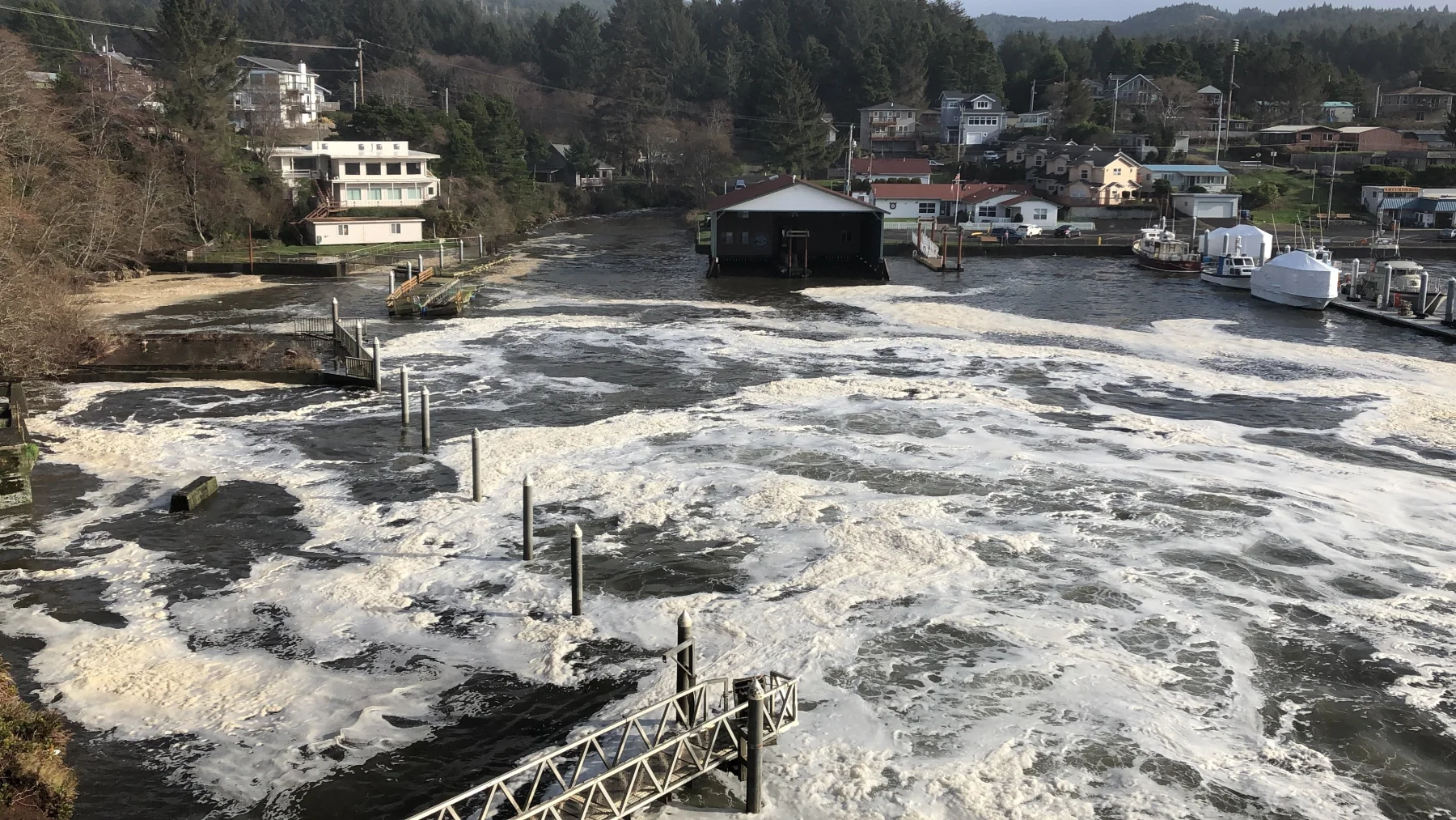
In this Jan. 11, 2020 photo, an extremely high tide arrives and floods parts of the harbor in Depoe Bay, Oregon, during a so-called “king tide” that coincided with a major winter storm.
Gillian Flaccus/AP
hide caption
Gillian Flaccus/AP
Residents of the Pacific Northwest are accustomed to heavy downpours. But atmospheric rivers are hitting, as warm ocean waters from El Niño contribute to sea level rise and fuel storm systems. And right now, these natural weather conditions coincide with the annual high tides, known as king tides. This puts coastal and inland waterways along the west coast at risk of flooding.
Ralph said that according to 40 years of data from the Federal Emergency Management Agency, 90 percent or more of all flood damage in the western United States is due to atmospheric rivers.
This weekend, Jeff Michalski, a meteorologist with the National Weather Service in Seattle, said the Washington coast could be hit by significant 20-foot swells.
Pineapple and rum
People may know atmospheric rivers by their nicknames, like Pineapple Express or Rum Runner Express. These names describe the origin of the atmospheric river. A Pineapple Express, which crossed the Pacific Ocean from Hawaii in late October, caused devastating flooding and multiple deaths in the Four Corners areas of the southwest.
Atmospheric rivers aren’t just a West Coast phenomenon. Some larger Northeast rivers on the East Coast can contain a “nasty” atmospheric river, said UCSD’s Ralph.
The term atmospheric river is one of the few technical scientific terms that has gained traction on social media and in the news in recent years, along with El Niño and Kelvin waves.
But is there a relationship between El Niño and atmospheric rivers? Do warm ocean temperatures associated with El Niño and the heat released by these waters make rivers stronger? That was Ralph’s theory in 2015, but his research showed otherwise.
“(Atmospheric rivers) don’t dance to the rhythm of El Niño,” Ralph said.
Climatologists say there is also not enough data to link weather patterns to human-caused global warming, even though global warming means more water vapor in the atmosphere.
“We need to keep our eyes open” to atmospheric rivers, Ralph said. “Whether it’s an El Niño year, a La Niña year or a No Niño year.”
Gn headline