
Weather in Tampa | Friday forecast
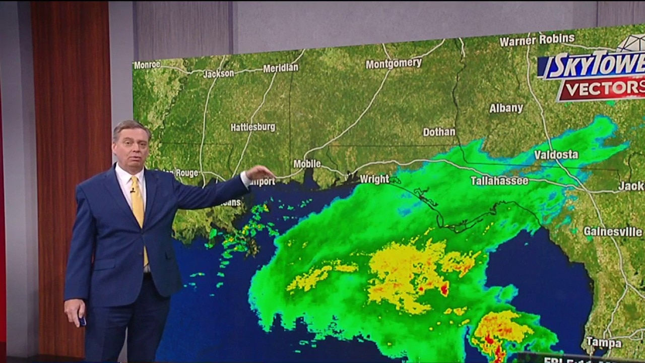
Fox 13 meteorologist Jim Weber said Friday’s forecast calls for Hurricane Isaias to intensify as it targets the Pensacola coast. Locally, that means higher than normal tides and temperatures up to 87 degrees today.
TAMPA, Florida. – Hurricane Isaias continues to intensify Friday morning with winds of 110 mph, putting the system on the verge of becoming a major Category 3 hurricane as it moves toward the northern Gulf Coast.
Major storm strengthens in Gulf
What we know:
Hurricane Isaias is gaining strength Friday morning, with winds of 180 km/h as it approaches major hurricane status.
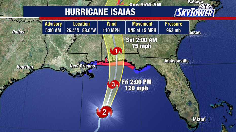
Forecasters expect wind shear to cause some weakening near the northern Gulf Coast, although the storm will remain dangerous.
Active warnings on the Gulf Coast
Chronology:
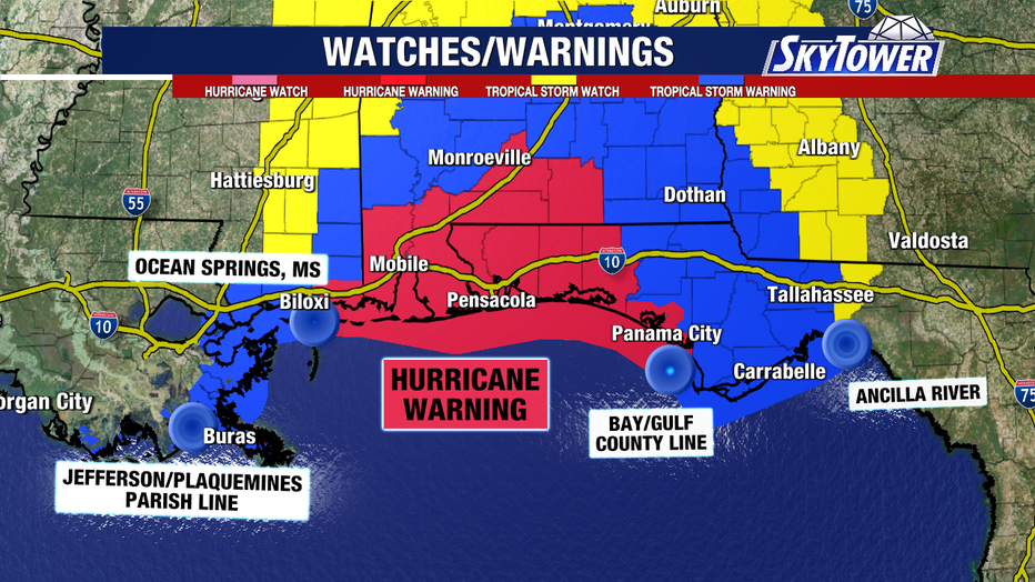
Hurricane warnings remain in effect from Ocean Springs, Mississippi, to the Bay-Gulf County border in the Florida Panhandle.
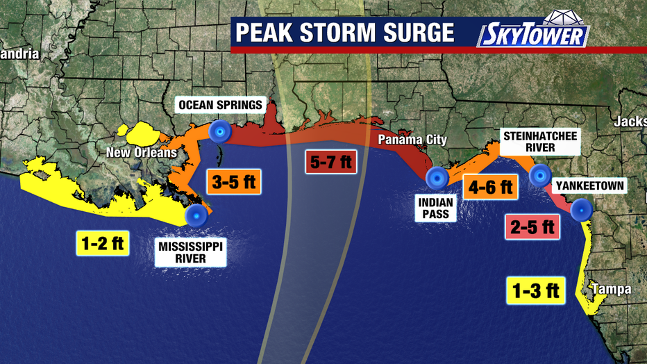
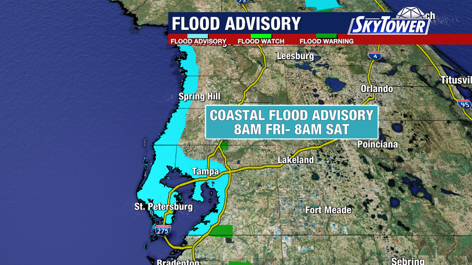
Storm surge near the center and east of landfall will reach 5 to 7 feet, with 1 to 3 feet of surge expected from Citrus to Pinellas counties Friday through the weekend.
Drier weather on the horizon
What’s next:
Tropical showers will remain likely through the weekend, causing minor coastal flooding in parts of Florida.
On Monday, the rain clears out as drier air lowers humidity levels and brings more sunshine early next week.
Threats of flooding along the Florida coast
What we don’t know:
Authorities have not yet determined the exact timing or landfall point of Hurricane Isaias along the Gulf Coast.
It is still unclear how severe localized flooding will be in the coastal areas subject to advisories.
The source : The information in this story was gathered from official weather reports and hurricane advisories issued Friday morning.
Gn usa