

The WPBF 25 First Warning Weather Team has designated Sunday and Monday to have impact weather.
WPBF 25 First Warning Meteorologist Nikki Sheaks said the area will see excessive precipitation.
WEATHER ALERTS
- A flash flood warning has been issued for Okeechobee County, including the town of Okeechobee Treasure Island, Taylor Creek, Four Seasons Estates, Okeechobee Airport, Whispering Pines and Basswood Estates until 4:15 p.m.
- The National Weather Service in Melbourne notes that law enforcement officials have reported thunderstorms producing heavy rain in the area at risk of flooding. Between three and six inches of rain has fallen and additional rain is possible. Flash floods are already occurring.
- Law enforcement officials report that portions of SR 70 and US 441 in and around the town of Okeechobee are impassable. Motorists should avoid these roads. Water was also entering the structures.
- The NWS advises motorists to turn around and not drown when encountering flooded roads, as most flood deaths occur in vehicles. Be aware of your surroundings and do not drive on flooded roads.
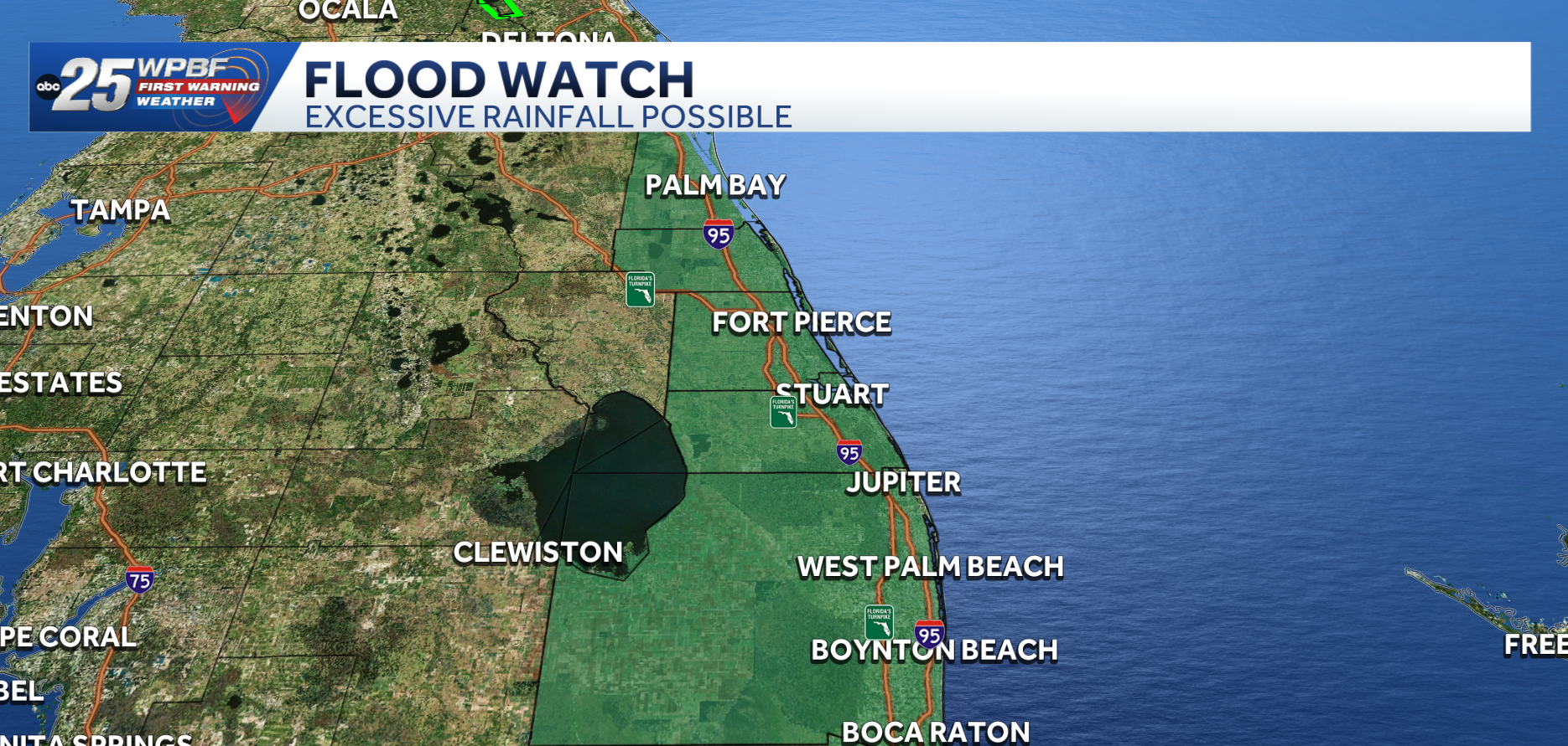
- A flash flood watch has been issued for Okeechobee County until Monday, November 2 at 3 p.m.
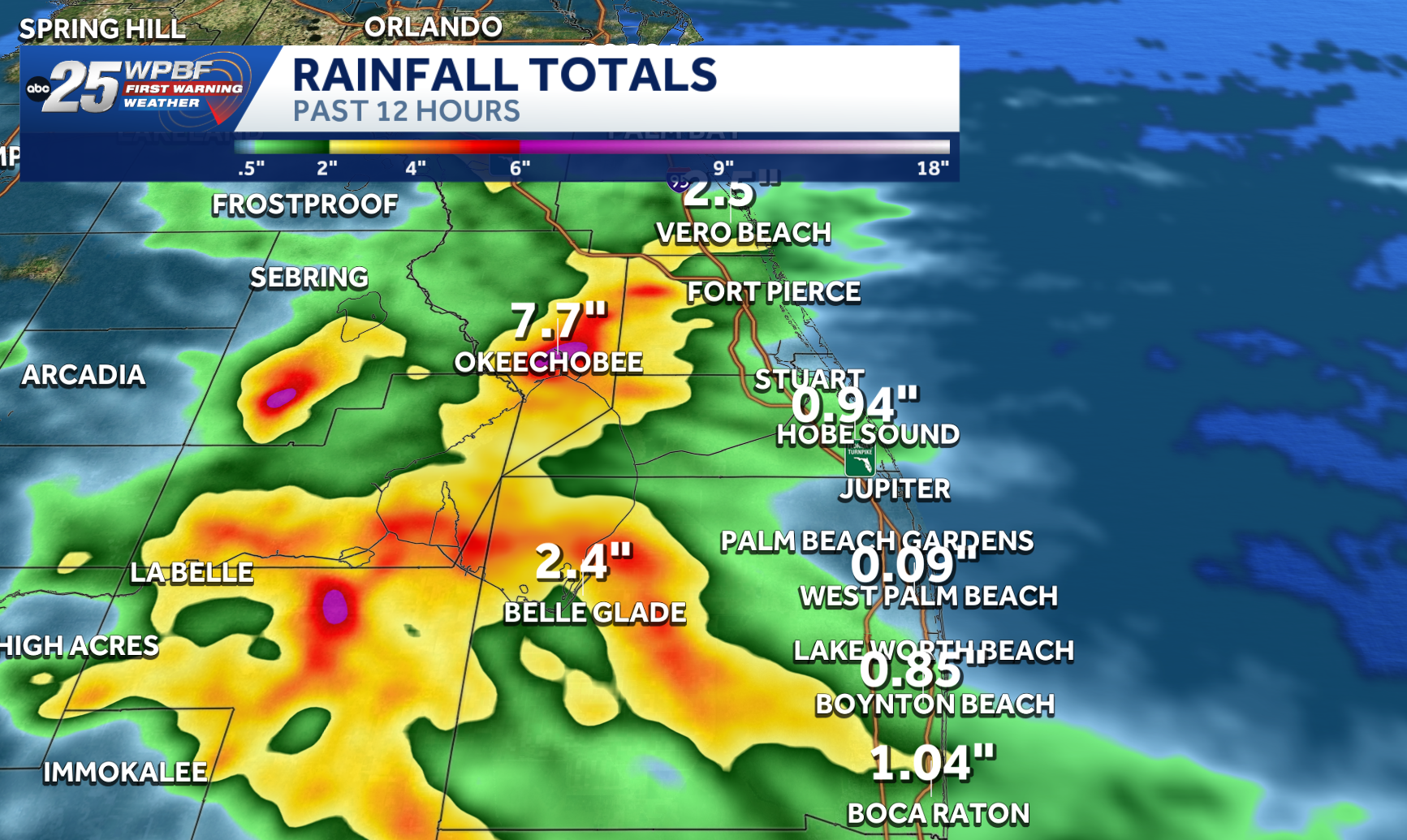
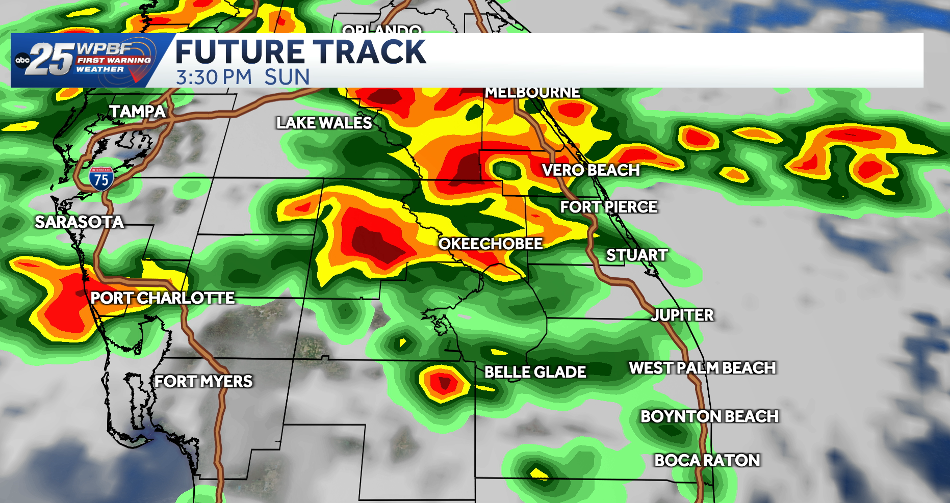
A Flood Watch has been issued through Monday as rainfall totals will be near three to five inches and there is a risk of rain accumulations of nearly five to seven inches in some areas.
Sunday morning there will be a chance of scattered rain over 50% of the area, with a chance of rain increasing to 60% Sunday afternoon.
Interactive radar: South Florida weather coverage from WPBF 25 News
The weather will be windy with sustained winds around 15 to 20 mph. High temperatures will be in the 80s.
Share with us: Upload your weather photos and videos via uLocal
MONDAY
There will be a 60% chance of scattered rain in the area as well as windy conditions.
Get the latest weather updates with the WPBF 25 News app. You can download it here.
Gn usa